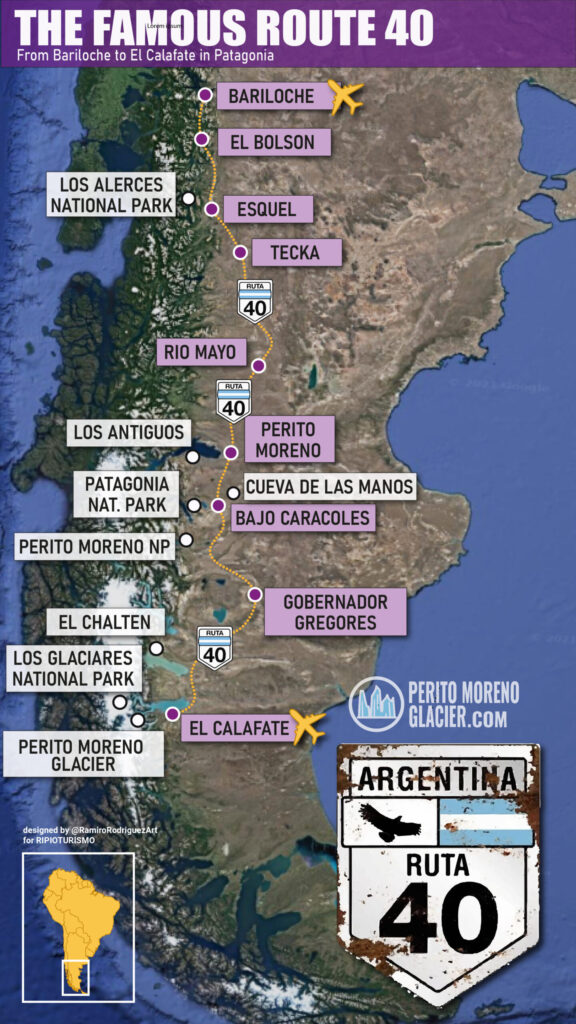
Route 40: Overview and General Facts
National Route 40 (Ruta Nacional 40, also named Libertador General Don José de San Martín in some sections) stretches from Cape Vírgenes in Santa Cruz to the Bolivia border at La Quiaca in Jujuy. It is the longest road in Argentina with a total length of 5,194 km, running roughly parallel to the Andes and passing by several national parks.
It crosses 11 provinces:
- Santa Cruz, Chubut, Río Negro, Neuquén
- Mendoza, San Juan, La Rioja, Catamarca
- Tucumán, Salta, Jujuy
Highlights along the route include: El Calafate and the Perito Moreno Glacier, Esquel, El Hoyo, Lago Puelo, El Bolsón, Bariloche, Villa La Angostura, San Martín de los Andes, Junín de los Andes, Chos Malal, Malargüe, the Wine Route in Mendoza and San Juan, dinosaur fossil areas in San Juan, hot springs in Catamarca, the Ruins of Quilmes, the Calchaquí Valleys, the high-altitude vineyards of Cafayate, the La Polvorilla viaduct crossed by the Train to the Clouds, and the altiplano landscapes of the Puna.
At Abra del Acay in Salta, Route 40 reaches nearly 5,000 m a.s.l., making it one of the highest roads in the Americas and the highest continuous route outside the Himalayas.
Is Route 40 paved or gravel?
Many assume it is mostly gravel. However, the entire stretch between Bariloche and El Calafate is paved, so driving there is straightforward.
Is it a busy road?
Generally, no. Average traffic is usually under 1,000 vehicles per day. Exceptions include the tourist corridor between El Bolsón and San Carlos de Bariloche, and between Pareditas in Mendoza and the city of San Juan, since Pareditas is a key connection for travel between Mendoza and San Rafael.
Seasonality and Conditions
Traffic is seasonal. In large areas of Patagonia, sections may become impassable due to winter snow from July to September. In northern Argentina, summer rains can raise river levels and cause temporary closures where there are no bridges.
How to Visit Route 40 in Patagonia
You can rent a car and drive independently, or join guided overland trips that connect destinations along the route.
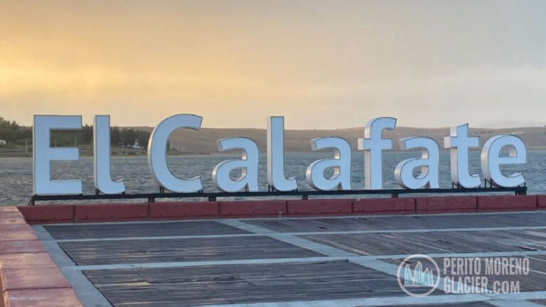
Good starting points with airports include Bariloche (Río Negro) and El Calafate (Santa Cruz). Other notable stops are El Bolsón and Lago Puelo National Park, Esquel and Los Alerces National Park, Bajo Caracoles and the Cave of the Hands, Los Antiguos, El Chaltén and the Fitz Roy Massif, and El Calafate with access to the Perito Moreno Glacier in Los Glaciares National Park.
Accommodation on Route 40
In major hubs such as Bariloche, Esquel, El Calafate, and El Chaltén you will find a wide range of hotels and lodges. Along rural stretches, consider staying at traditional Estancias. These ranches offer authentic hospitality, local cuisine, and outdoor activities that help you connect with Patagonian culture and landscapes.
How Long Is Route 40?
From La Quiaca on the Bolivian border to Cabo Vírgenes in southern Patagonia, Route 40 covers 5,194 km. The segment from Bariloche to El Calafate is approximately 1,512 km.
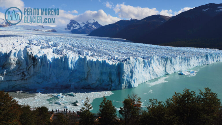
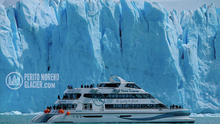
Route 40 ranks among the world’s most memorable road trips thanks to its unique scenery, length, extreme altitudes, and variety of regions. The most famous portion is in Patagonia, from the Lakes District south to El Calafate, gateway to the Perito Moreno Glacier and other spectacular ice fields in Los Glaciares National Park.
Best Season to Travel Route 40 in Patagonia
Winter driving is not recommended due to snow, ice, and short daylight. The most favorable period is October to March, with longer days, more stable weather, moderate temperatures, and mostly clear roads.
Route 40 Through Patagonia: Key Sections
From Bariloche to El Calafate
This extensive section, nearly 2,500 km, lets travelers immerse themselves in the breadth of Argentine Patagonia, from the lake region around Bariloche to the steppe and glacier country near El Calafate.
Bariloche, El Bolsón, Esquel, and Los Alerces National Park
San Carlos de Bariloche is a major gateway to the Lakes District. South of Bariloche, Route 40 threads through El Bolsón and nearby Lago Puelo National Park, then continues to Esquel and Trevelin near the La Hoya ski center.
From Esquel, you can visit Los Alerces National Park, a UNESCO World Heritage Site since 2017, famed for ancient larches, emerald lakes, and pristine waterfalls.
From Esquel to Gobernador Gregores
Continuing south through Chubut, the road passes Tecka, Gobernador Costa, Alto Río Senguer, and Río Mayo before entering Santa Cruz. Next come Perito Moreno and Los Antiguos on the southern shore of Lake Buenos Aires. This area gives access to Cueva de las Manos, a UNESCO site, and to Posadas Lake, known for sport fishing and striking scenery.
Gobernador Gregores serves as a regional hub, with access to Lake Cardiel and Lake Strobel, both renowned among anglers.
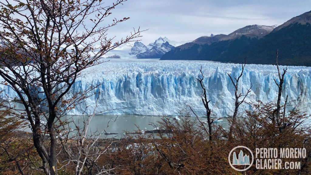
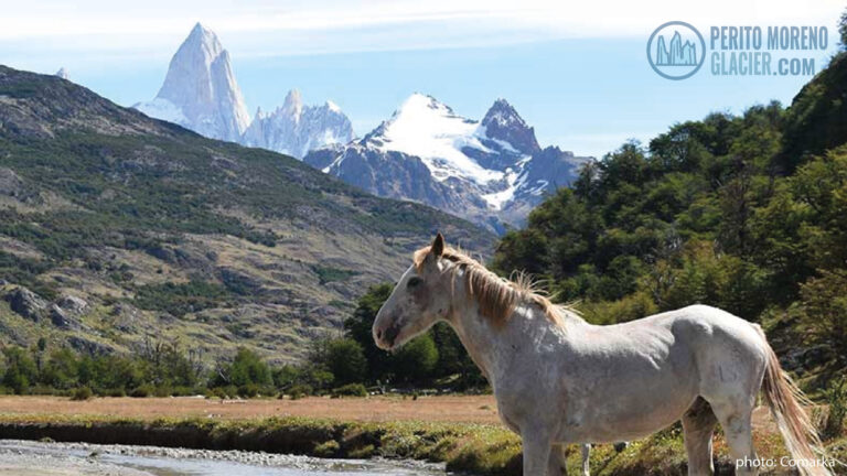
From Gobernador Gregores to El Chaltén and El Calafate
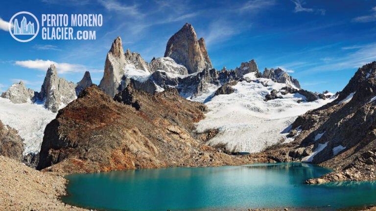
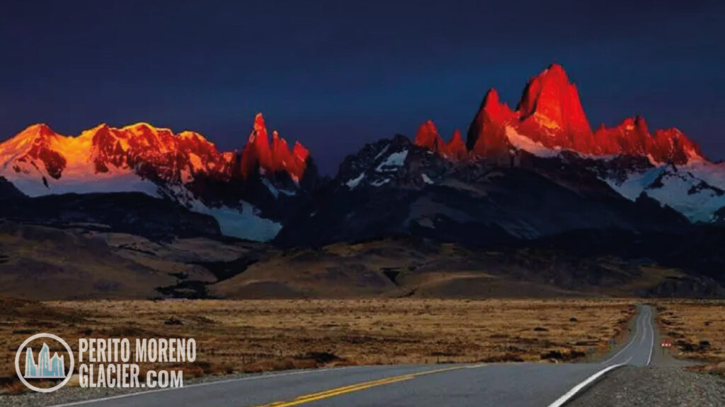
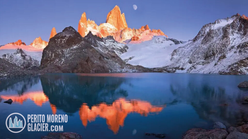
Further south, a spur leads into El Chaltén within Los Glaciares National Park, Argentina’s trekking capital since 1994, with trails to the Fitz Roy and Cerro Torre viewpoints. The journey ends at El Calafate on Lake Argentino, the main base to visit the Perito Moreno Glacier and to join lake excursions and glacier walks.