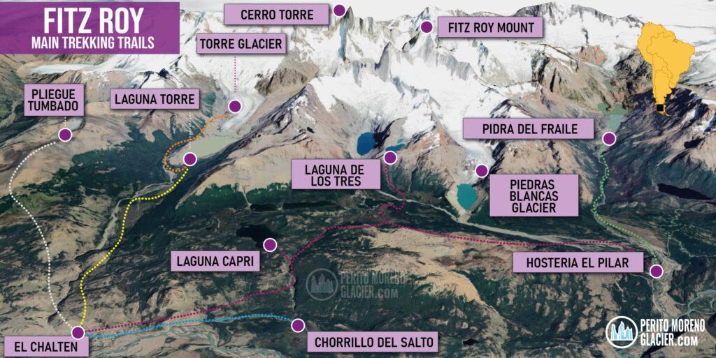
Trekking Trails in El Chaltén and the Fitz Roy Massif
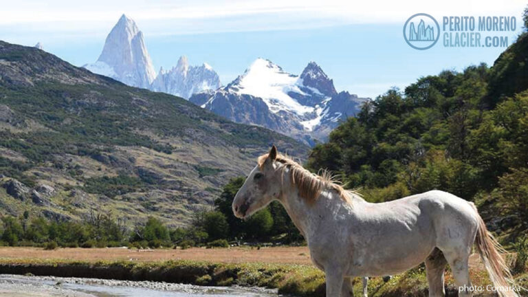
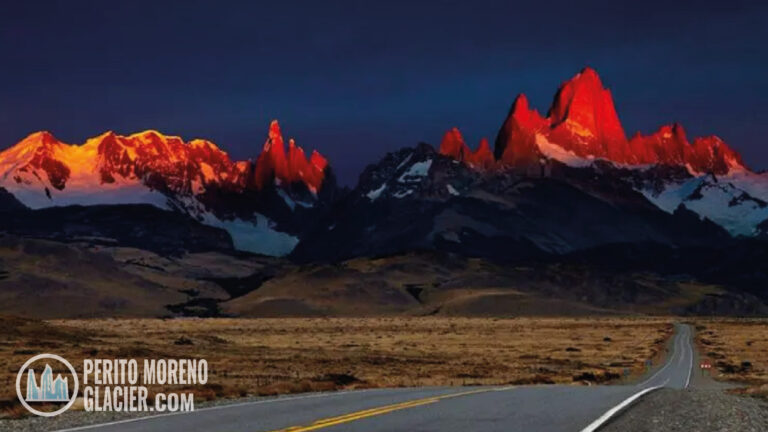
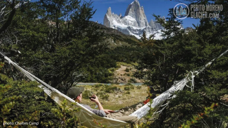
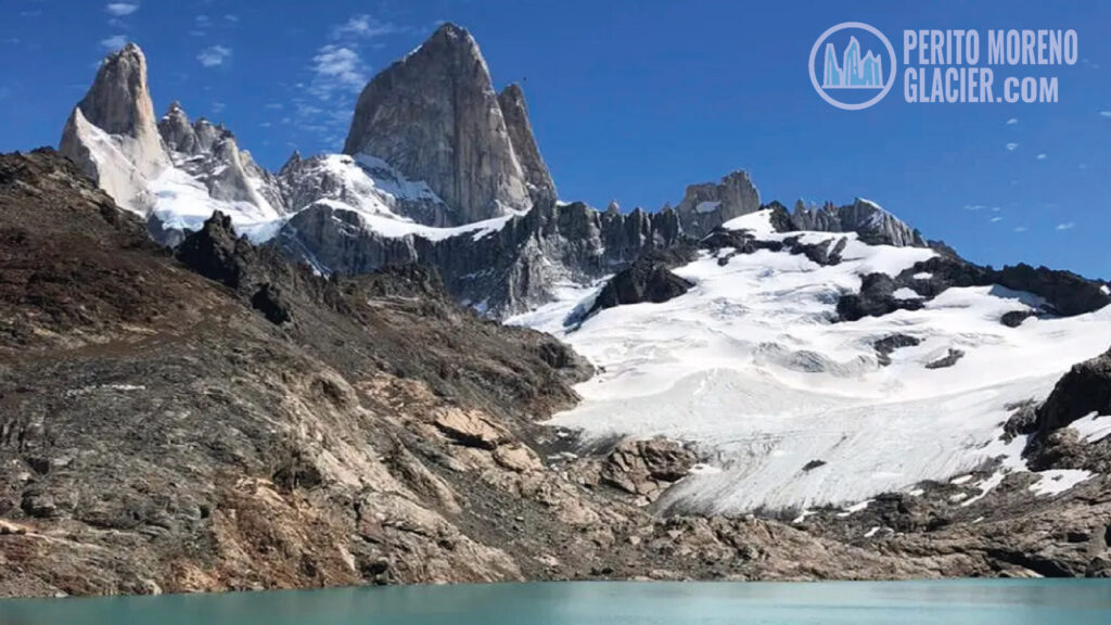
El Chaltén is the gateway to a network of trails around the Fitz Roy Massif. The iconic Mount Fitz Roy crowns this dramatic landscape on the border of Argentina and Chile, beside El Chaltén village and Lake Viedma. The first ascent was achieved in 1952 by French alpinists Lionel Terray and Guido Magnone, a milestone in mountaineering history.
Today, the area offers routes for every level. If you are new to mountain walking or unsure about your fitness, start with short walks, then progress to longer hikes. Choose the trail that best suits your pace and enjoy Patagonia’s breathtaking scenery.
Easy Walks
Great introductions to El Chaltén’s landscapes. Gentle gradients and short distances.
Trekking to Cascada Margarita
Duration: 2 hours
Difficulty: Easy
Start on the Laguna Torre footpath from El Chaltén. A brief ascent enters a small ñire forest on a comfortable incline. The trail rises alongside the Fitz Roy River to a natural viewpoint on a cliff edge. Enjoy wide views of the valley with Mount Solo to the left, the Adela range, Mount Torre, and Mount Fitz Roy to the right. Across the canyon you will see the Margarita waterfall. If you have time, continue about one hour to the classic Mount Torre viewpoint.
Trekking to Los Cóndores and Las Águilas
Duration: 2 hours
Difficulty: Easy
Cross the Fitz Roy River bridge and walk to the National Park Visitors’ Centre, the trailhead. A signed gate on the left marks the path. After about 30 minutes you reach the Los Cóndores viewpoint, ideal for watching condors riding the thermals between the De las Vueltas and Fitz Roy river valleys. This trail opened in 2004 and includes informative signage. From the bifurcation, a short, gentle path leads to the Las Águilas viewpoint with sweeping views of Lake Viedma, Cerro Huemul, and Cerro Pirámide.
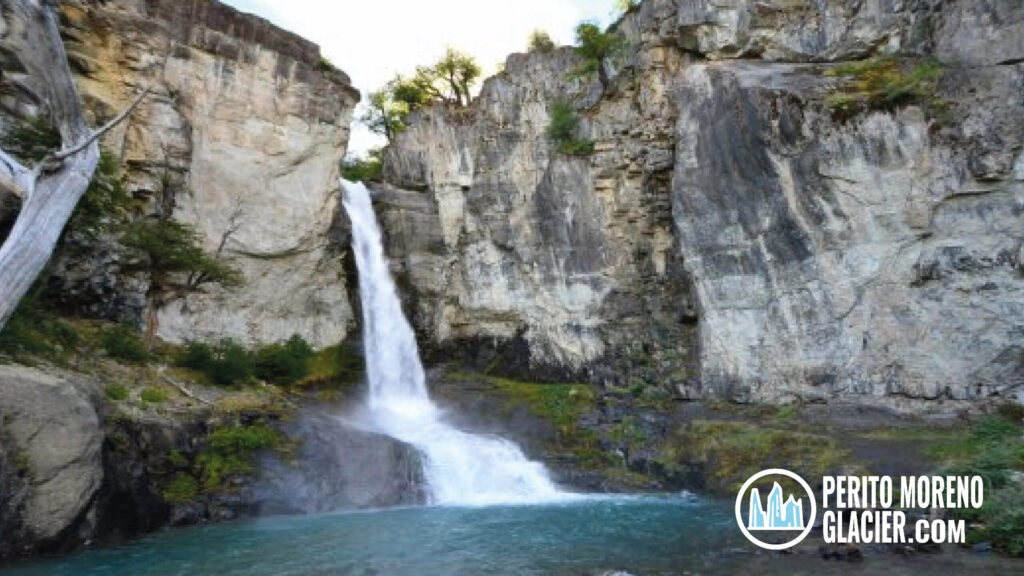
Chorrillo del Salto
Duration: 2 hours
Difficulty: Easy
This pleasant walk follows a simple forest path to a beautiful waterfall and stream. Begin at the end of Av. San Martín in El Chaltén, near the Laguna de los Tres trailhead, and take the ascending path to the right. Descend toward Provincial Route 41 to Lago del Desierto. Signs indicate the bike path entrance and the start of the Chorrillo del Salto footpath. The final stretch is flat through low forest, with the waterfall audible ahead. In season you may spot the delicate Magellanic orchid along the trail. The waterfall sits on the Arroyo del Salto before it flows into the De las Vueltas River. The round trip is under 4 km from town.
Full-Day Treks
For hikers used to longer distances and higher effort, these classic full-day routes deliver the region’s most famous vistas.
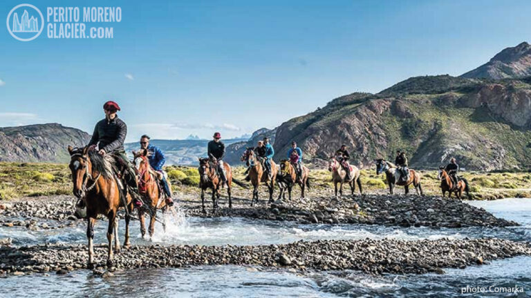
Full Day Adventure in El Chalten: Horse Riding, Trekking & Kayak
A wonderful full day adventure tour in El Chalten area: horseback riding + trekking + kayaking!
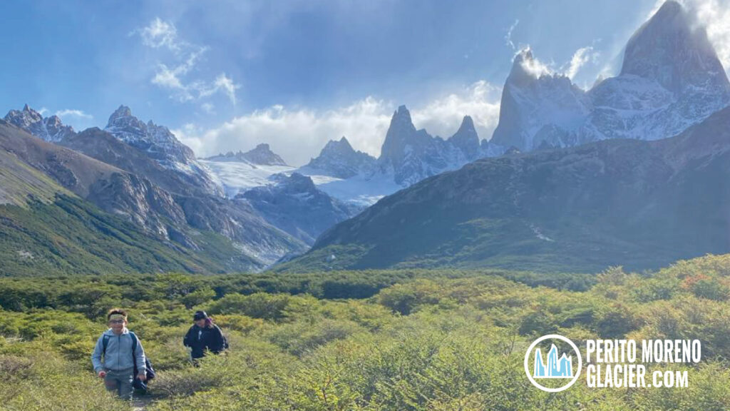
Trekking to Laguna Torre
Duration: 8 hours
Difficulty: Moderate
Two main trails depart El Chaltén and join within five minutes. The path follows the Fitz Roy River valley toward its headwaters. In about 15 minutes you reach the first viewpoint with grand views of Cerro Solo, the Adela range, Cerro Torre, and Mount Fitz Roy. A natural balcony offers further panoramas of the granite spires. The route passes the De Agostini base camp, then climbs the frontal moraine to reach Laguna Torre, often dotted with small icebergs. Sunrise lights the granite walls with warm color, a reward for those camping at De Agostini.
Trekking to Laguna de los Tres
Duration: 9 hours
Difficulty: Moderate
Begin at the end of Avenida San Martín. A steep first hour leads to a viewpoint over the De las Vueltas valley. Continue along the Del Salto stream toward Mount Fitz Roy. Wayfinding signs and a rocky balcony help interpret the landscape. Reach Poincenot Base Camp, then tackle a steep final ascent to Laguna de los Tres, with extraordinary views of the lagoon and the De los Tres Glacier. From the moraine you can also admire Laguna Sucia and its hanging glaciers.

Hike to Laguna de Los Tres (Fitz Roy Massif) from El Chalten
Enjoy the main trekking in the area as it leads us to the foot of the mythical Mount Fitz Roy.
Trekking to Pliegue Tumbado
Duration: 8 hours
Difficulty: Moderate
Start at the Ceferino Fonzo Visitors’ Centre. The trail gains about 1,100 meters to a viewpoint near 1,500 meters above sea level. Cross the open Pampa de las Carretas with sights of Mount Huemul, Lake Viedma, and the Andes. Forest gives way to scrub and rocky ground where marine fossils over 100 million years old can be found in situ. The summit area offers one of the best panoramas in the park.