Brazo Rico and Canal de los Témpanos are two connected sectors of Lago Argentino beside the terminal front of Perito Moreno Glacier. Brazo Rico lies on the glacier’s southern side. Canal de los Témpanos—literally “Iceberg Channel”—lies to the north and opens toward the main body of Lago Argentino.
The glacier advances from the Andes toward Península de Magallanes, the forested landform where the famous visitor walkways are located. When its front reaches the peninsula, the ice can temporarily interrupt the natural drainage from Brazo Rico toward Canal de los Témpanos. That unusual arrangement explains both the glacier’s celebrated dam-and-rupture cycle and the very different visitor experiences available on its two faces.
The easiest mental picture is this:
- South of the glacier: Brazo Rico, Bajo de las Sombras port, ice-trekking crossings and south-face navigations.
- North of the glacier: Canal de los Témpanos, Puerto Moreno, icebergs drifting toward the wider lake and views of the north face.
- East of the glacier: Península de Magallanes and the walkway system, positioned between the two sectors.
- West of the terminus: the glacier extends back toward the Southern Patagonian Ice Field.
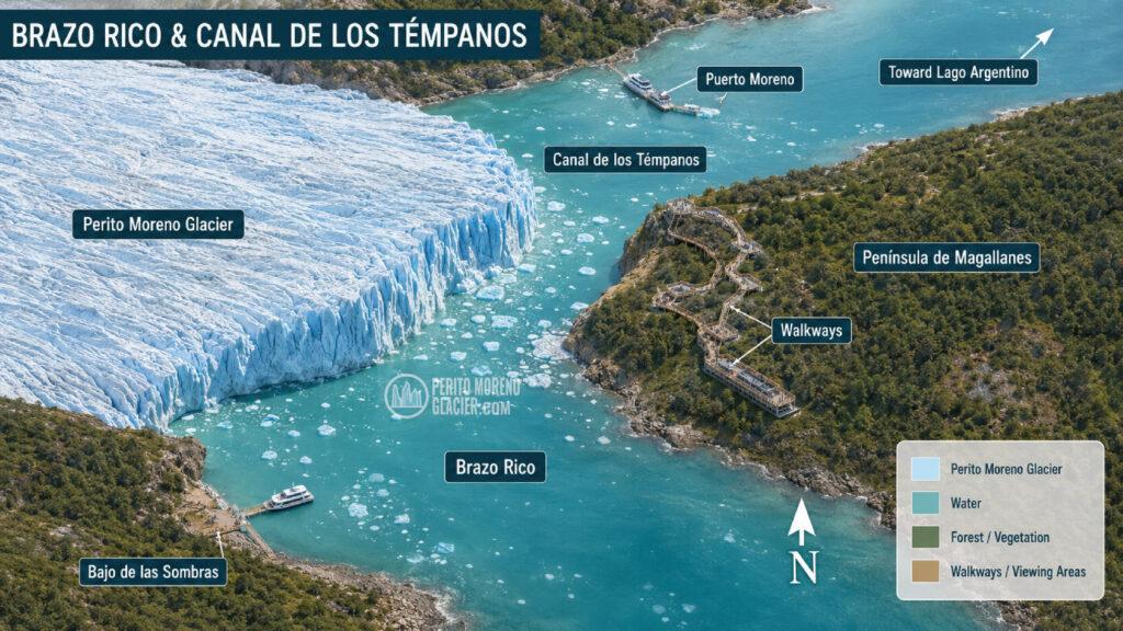
Visual placement — Orientation plan
Caption: The visitor area around Perito Moreno Glacier: Brazo Rico lies south of the ice front, while Canal de los Témpanos opens northward toward Lago Argentino.
Alt text: Plan showing Perito Moreno Glacier, Brazo Rico, Canal de los Témpanos, Península de Magallanes, the walkways and nearby ports.
Complete Tour to Perito Moreno Glacier: Boat Navigation & Lunch
Enjoy a Perito Moreno Glacier tour from el Calafate in a full day, with lunch and boat navigation included
Where are Brazo Rico and Canal de los Témpanos?
Both are in the southern sector of Lago Argentino, within Los Glaciares National Park in Santa Cruz Province, Argentina. They are not separate lakes. They are named parts of the same large glacial lake system, shaped by valleys that were excavated and later flooded as Patagonian ice retreated.
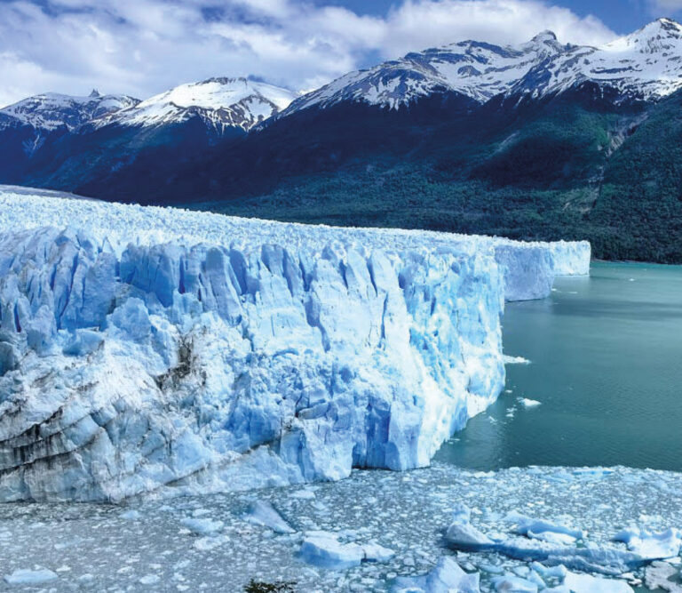
Perito Moreno Glacier reaches Lago Argentino from the west. Its broad terminal front faces Península de Magallanes, leaving water on both its northern and southern sides. This is what makes a single visit feel like several different landscapes: the water, shoreline, ice face and navigation routes change depending on which side you are observing.
Where is Brazo Rico?
Brazo Rico is the enclosed-looking arm on the southern side of the glacier. It extends away from the immediate glacier area and connects with Brazo Sur, forming a large southern basin within the Lago Argentino system.
Travelers usually enter the Brazo Rico sector before reaching the walkways. Provincial Route 11 runs close to parts of its shoreline, and Bajo de las Sombras—the port used for many south-side boat crossings—is located here. Minitrekking and other organized glacier experiences generally begin with a navigation across this arm, although itineraries and commercial names can change.
Brazo Rico can appear calm and sheltered, but conditions are still Patagonian. Wind can increase quickly, cold air descends from the ice, and the water is never suitable for independent swimming or casual paddling near the glacier.
Where is Canal de los Témpanos?
Canal de los Témpanos lies on the northern side of the Perito Moreno front. It leads away from the glacier toward the larger Lago Argentino basin and is part of the natural drainage route for the southern arms of the lake.
Its Spanish name means “Channel of the Icebergs.” The name makes sense at first sight: pieces calved from the glacier may float through this sector before melting, grounding in shallower water or moving farther into the lake under the influence of wind and currents.
Puerto Moreno, below the walkway area, is associated with short north-face navigations. Some longer Lago Argentino itineraries also enter Canal de los Témpanos, depending on their route, weather conditions and operating schedule. Argentina’s National Parks Administration lists navigation toward the north wall of Perito Moreno Glacier among the activities in this area.
Why does the glacier separate the two sectors?
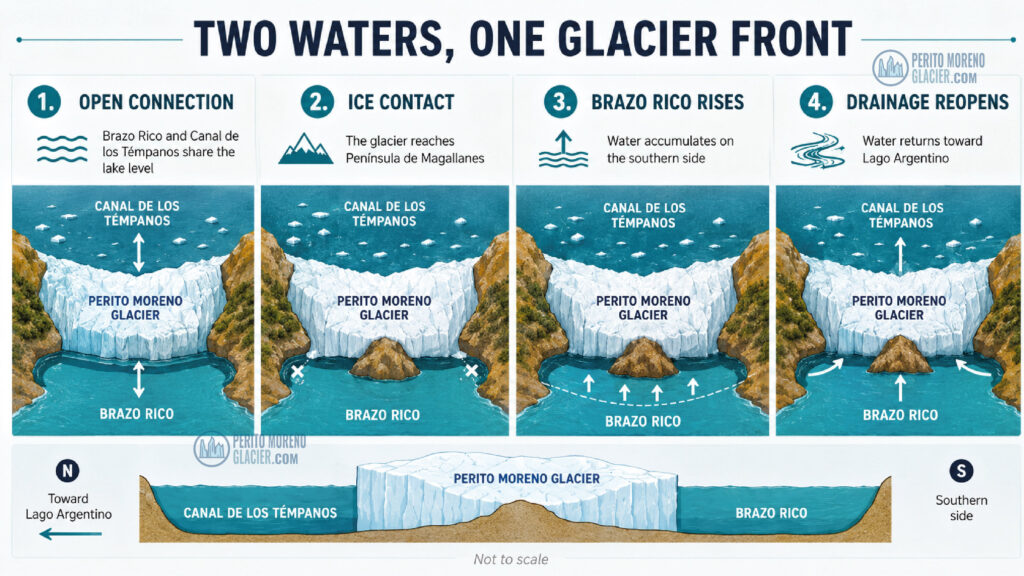
The Perito Moreno Glacier flows eastward until its terminus approaches Península de Magallanes. The narrowest contact zone is near the peninsula’s southwestern tip. When ice reaches and presses against that land, it behaves like a temporary natural barrier between Brazo Rico and Canal de los Témpanos.
Under ordinary open-channel conditions, the water sectors communicate and tend toward a shared lake level. If the contact becomes sufficiently complete, drainage from Brazo Rico and Brazo Sur is restricted. Water then accumulates on the southern side and a difference in level develops across the ice barrier.
Eventually, water may find or enlarge a passage beneath the glacier. A tunnel can grow, an ice arch may form, and the connection can reopen. The spectacular collapse of that arch is the visible finale most people call “the rupture,” but the important geographic story begins much earlier—with two water sectors separated by an advancing glacier front.
This article intentionally keeps the sequence concise. For the full physical process, historical events and terminology, link to The Rupture of Perito Moreno Glacier: All You Need to Know.
Brazo Rico vs. Canal de los Témpanos
| Feature | Brazo Rico | Canal de los Témpanos |
|---|---|---|
| Position relative to the glacier | South | North |
| Position in the lake system | Southern arm connected with Brazo Sur | Channel opening toward the main Lago Argentino basin |
| Glacier face commonly observed | South face | North face |
| Typical visitor access | Route 11 viewpoints and Bajo de las Sombras operations | Walkway-side viewpoints, Puerto Moreno and selected longer navigations |
| Common association | Boat crossings for organized ice activities | Iceberg views and north-face navigation |
| Role during an ice-dam phase | Water may accumulate here | Downstream side toward the main lake |
The table is a guide to orientation rather than a rigid excursion catalog. Boat routes, departure points and activity logistics can vary by operator, season, weather, lake conditions and park authorization.
Which side do you see from the Perito Moreno walkways?
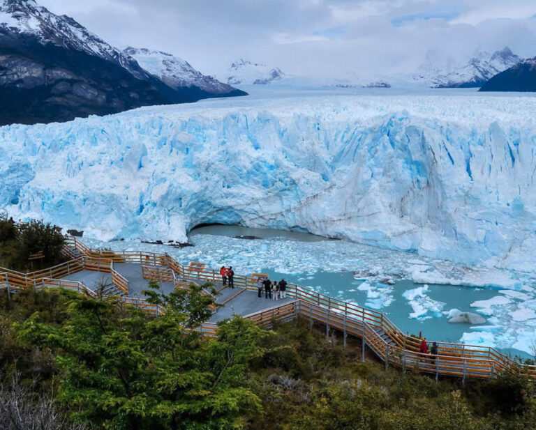
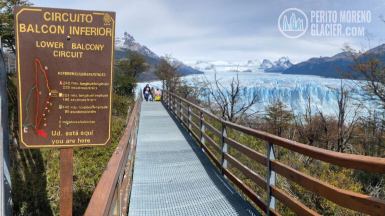
The walkway network spreads across the western edge of Península de Magallanes, almost directly opposite the glacier. Because the peninsula sits between the two water sectors, visitors can see more than one part of the terminal front during the same visit.
Central and lower viewpoints concentrate attention on the dramatic contact zone and the immense central wall. As you move through the circuits, the viewing angle changes: some balconies open toward Brazo Rico and the south face, while others look toward Canal de los Témpanos and the north face. This is one reason the walkways are worth exploring rather than treating as a single photo stop.
Look for three orientation clues:
- The port and excursion traffic. Boats operating from the Brazo Rico side are associated with the southern face; departures immediately below the main walkway complex face Canal de los Témpanos.
- The shape of the water. Brazo Rico reads as a broad arm extending southward, while Canal de los Témpanos points toward the open Lago Argentino system.
- The glacier–peninsula contact. This narrow meeting point is the hinge between the two sectors and the key to understanding the landscape.
For trail selection, accessibility and time estimates, add an internal link to Perito Moreno Glacier Walkways: Complete Visitor Guide once its final URL is confirmed.
What can travelers do on Brazo Rico?
Take a south-face navigation
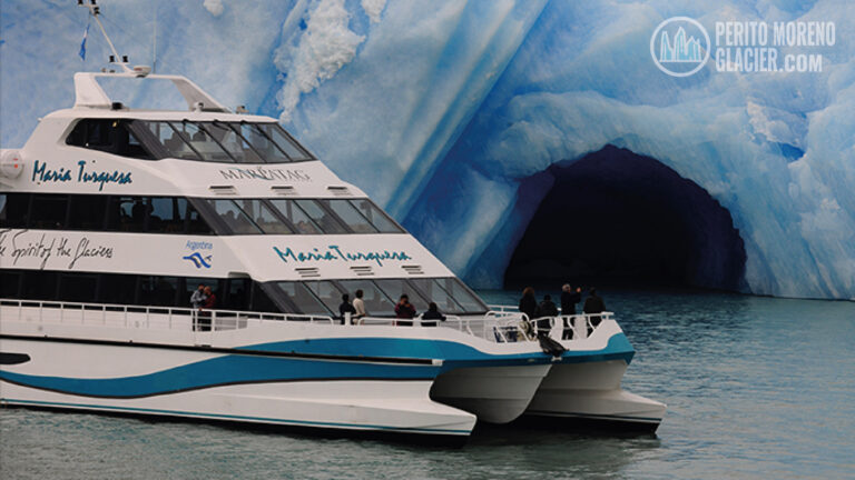
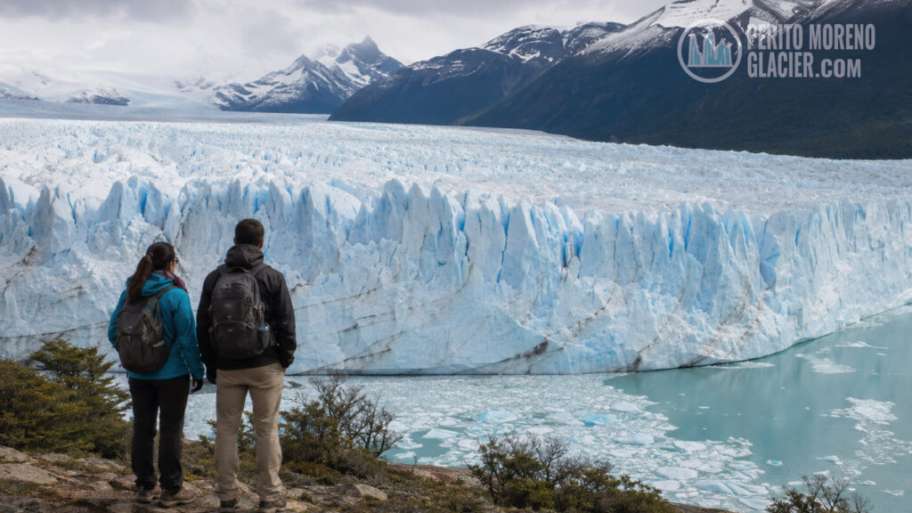
Short boat trips on Brazo Rico provide a low, water-level perspective of the glacier’s southern wall. From the lake, the height and texture of the ice become easier to appreciate than from a distant panoramic balcony. Safe-distance rules are set by crews and park authorities because calving can create waves and unstable floating ice.
Cross the arm for an organized glacier activity
Several guided experiences use a boat crossing from Bajo de las Sombras to reach the glacier’s southern shore. The navigation is only one component: hiking access, age limits, physical requirements, equipment and time on or near the ice depend on the specific activity. Travelers should compare the current product description rather than assume every “glacier trek” follows the same route.
Observe the changing southern shoreline
During major historical damming events, the higher water level in Brazo Rico affected shorelines and vegetation. When levels fell again, exposed bands offered a visible record of the change. Today’s appearance depends on the glacier’s current position and hydrological conditions, so visitors should not expect dramatic water-level differences on an ordinary day.
El Calafate Tour Package: 1–3 Nights
Enjoy visiting Perito Moreno Glacier and other amazing attractions in the area. Choose between our 1-2-3 night packages and discover Patagonia
What can travelers do in Canal de los Témpanos?
Navigate toward the north face
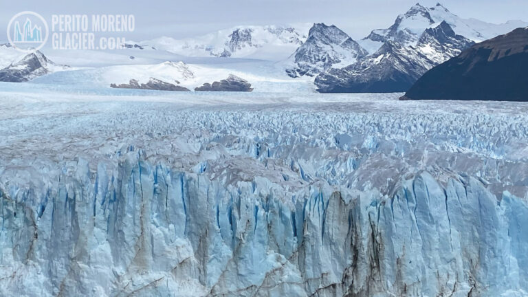
A north-face boat trip complements the walkway view with a closer look at crevasses, seracs and calving scars. The vessel does not approach the wall without limits; captains maintain the authorized safety distance and may adjust the route according to ice and wind.
Watch floating ice without confusing every piece with a “glacier rupture”
Calving is a normal process at a tidewater or lake-terminating glacier front. A block falling into the water may be impressive, but it is not automatically the famous rupture event. In Canal de los Témpanos, visitors can often see the everyday result of calving: floating fragments of different shapes, colors and sizes.
Include the channel in a broader lake itinerary
Some longer excursions combine parts of Lago Argentino and may include Canal de los Témpanos or the north face of Perito Moreno. Routes are not interchangeable: a cruise focused on Upsala and Spegazzini glaciers may offer a very different itinerary from a short Perito Moreno navigation. Confirm the named glacier faces and landing points before booking.
For broader lake geography, link to Lago Argentino: Perito Moreno Glacier Area.
Which side is better: Brazo Rico or Canal de los Témpanos?
Neither is universally better. They answer different travel interests.
- Choose a Brazo Rico experience if your priority is the south face, a boat crossing linked to a guided ice activity, or a quieter view framed by the southern shore.
- Choose a Canal de los Témpanos experience if you want the north face, floating-ice scenery or a navigation that connects naturally with the walkway sector or a wider Lago Argentino itinerary.
- Combine walkways and one navigation if this is your first visit. The elevated panorama explains the scale; the boat reveals the vertical structure of the ice.
- Consider both sides only if the routes are genuinely different and your schedule allows it. Two similar one-hour sailings may add less variety than combining a navigation with the walkway circuits.
Practical tips for understanding the landscape on arrival
Do not rely only on “left” and “right”
Those directions reverse depending on where you stand. Use north/south and the named water sectors. Brazo Rico is south of the glacier; Canal de los Témpanos is north.
Check the exact departure port
“Perito Moreno boat tour” does not identify the route. Bajo de las Sombras generally indicates the Brazo Rico sector, while Puerto Moreno below the walkways indicates Canal de los Témpanos. Longer cruises may depart elsewhere and enter the channel later.
Expect route changes
Patagonian wind, floating ice, visibility and park instructions can change the operating plan. A safe alteration is not a lesser experience; it is part of navigating an active glacial environment.
Keep the map interpretive, not predictive
A map can explain the setting, but it cannot predict the next dam, tunnel, calving event or rupture. The glacier and lake are dynamic, and the contact configuration can change over time.
Frequently asked questions
Are Brazo Rico and Canal de los Témpanos separate lakes?
No. Both belong to the Lago Argentino system. Brazo Rico is a southern arm, while Canal de los Témpanos is a channel on the northern side of the Perito Moreno Glacier front that opens toward the main lake.
What does “Canal de los Témpanos” mean in English?
It means “Iceberg Channel.” In everyday travel English, both the Spanish name and the translation are used.
Is Brazo Rico the same as Lago Rico?
Brazo Rico is the most useful geographic term for travelers. Some descriptions—especially when discussing the damming cycle—use “Lago Rico” for the temporarily impounded southern water body. The names may refer to the same immediate hydrological sector in that context, but Brazo Rico avoids suggesting that it is permanently a separate lake.
Which side contains the famous rupture point?
The critical contact is where the glacier front reaches Península de Magallanes, between Brazo Rico and Canal de los Témpanos. The ice arch associated with a rupture forms at this connecting zone, not across the entire five-kilometer-wide front.
Can you walk from Brazo Rico to Canal de los Témpanos?
Visitors can move through the authorized walkway area on Península de Magallanes and view sectors oriented toward both sides. There is no independent shoreline route through the glacier contact zone, and travelers must never leave marked trails or approach unstable ice.
Where are most icebergs visible?
Floating ice can appear on either side following calving, wind and current patterns. Canal de los Témpanos is especially associated with drifting ice by name and geography, but sightings and concentrations vary daily.
Can a boat pass directly between the two sectors beside the glacier?
Not as an ordinary through-route at the contact point. The glacier and Península de Magallanes create a narrow, dynamic and potentially obstructed zone. Excursions operate in authorized sectors and follow current safety conditions.
A landscape that makes more sense once you know its names
Brazo Rico and Canal de los Témpanos are more than labels on a map. Together they explain why Perito Moreno Glacier can be experienced from contrasting faces, why excursion routes begin at different ports, why the peninsula is such an exceptional viewing platform and how the glacier can temporarily alter the drainage of a vast lake system.
Remember one simple orientation rule when you arrive: Brazo Rico is south, Canal de los Témpanos is north, and Península de Magallanes stands between them. With that framework, every balcony, boat route and iceberg becomes part of one readable Patagonian landscape.
Recommended internal links
- Primary contextual link: Lago Argentino: Perito Moreno Glacier Area
- Rupture detail: The Rupture of Perito Moreno Glacier: All You Need to Know
- Activity overview: What to Do at the Perito Moreno Glacier?
- Ice-trekking context: Ice Trekkings over Perito Moreno Glacier: Minitrekking and Big Ice
El Calafate Special Adventure Program: Big Ice and Horseback Riding or Trekking in Estancia Cristina
Enjoy visiting Perito Moreno Glacier, walking over the ice of the glacier and a wonderful trekking or horseback riding in a remote estancia in the national park

El Calafate, Perito Moreno Glacier, Glaciers Gourmet Cruise & Estancia Nibepo Aike
A wonderful 4-night program to visit Perito Moreno, navigate the Lake Argentino and staying in a typical Patagonian Ranch!