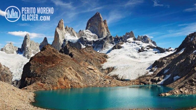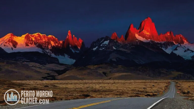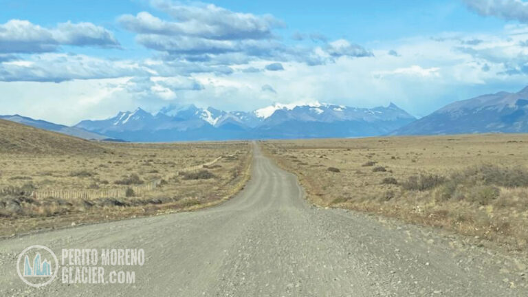
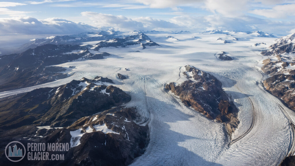
The Southern Patagonia Ice Field is not a single glacier and it is not one conventional attraction with an entrance gate. It is a vast, high-altitude reservoir of compacted snow and ice spread across the southern Andes, shared by Argentina and Chile. From this frozen interior, immense outlet glaciers descend toward turquoise lakes on the eastern side and into deep Pacific fjords on the west.
For travelers, that distinction changes the way the region should be understood. Most visitors never stand on the central plateau—and do not need to. They encounter the ice field through its accessible edges: the Perito Moreno Glacier, the iceberg-filled arms of Lago Argentino, the Upsala and Spegazzini glaciers, the Viedma basin near El Chaltén, Grey Glacier in Torres del Paine, and remote viewpoints where the scale of the landscape finally becomes visible.
This guide explains what the Southern Patagonia Ice Field is, why it looks so different from one side of the Andes to the other, where ordinary travelers can experience it, and when a visit becomes a true expedition requiring specialist preparation.
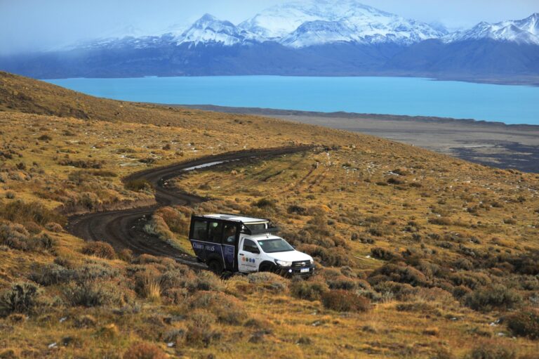
4×4 Adventure in Patagonia: Cerro Frías Exploration
Experience a thrilling 4x4 journey through Patagonia, featuring breathtaking views and unique landscapes.
What Is the Southern Patagonia Ice Field?
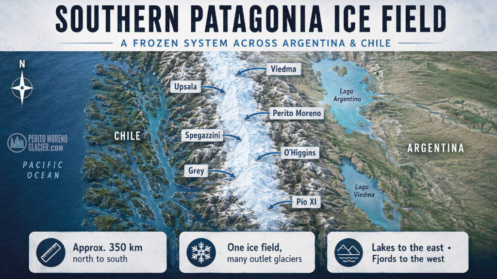
The Southern Patagonia Ice Field—known in Spanish as Campo de Hielo Patagónico Sur and in Chile as Campo de Hielo Sur—is an interconnected mass of glacial ice in the southern Patagonian Andes. It extends for roughly 350 kilometers from north to south and covers approximately 13,000 square kilometers, although published estimates vary according to the year, dataset and method used to define its boundaries.
It is generally described as the largest temperate ice mass in the Southern Hemisphere and one of the world’s largest contiguous ice fields outside the polar regions. “Temperate” does not mean warm: it means that much of the ice is close to its melting point, allowing meltwater and rapid internal movement to play an important role in glacier behavior.
An Ice Field Is Not the Same as a Glacier
A glacier is a body of ice that moves under its own weight, usually following a valley or descending from a larger accumulation zone. An ice field is the broader highland ice mass from which multiple glaciers flow outward.
Imagine an enormous frozen watershed. Snow accumulates in the high Andes, compresses into ice, and slowly moves away from the central divide. Mountain ridges and peaks interrupt the surface, but the accumulation zones remain connected across broad areas. The ice then drains through different outlet glaciers, just as water from a watershed leaves through different rivers.
Perito Moreno, Upsala, Spegazzini, Viedma, Grey, O’Higgins and Pío XI are therefore not isolated natural monuments. They are different outlets of the same regional ice system.
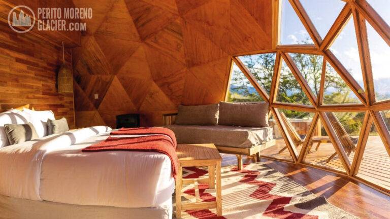
Perito Moreno Glacier & Pristine Luxury Camp – 4 Nights
A wonderful 4-night program to visit Perito Moreno Glacier from El Calafate and finalizing with a glamping experience!
A Surviving Fragment of a Much Larger Ice Sheet
During the last glacial periods, ice covered a far greater portion of Patagonia. Repeated advances carved valleys, deepened lake basins, polished rock and deposited moraines across the landscape. As the climate warmed, most of that ice disappeared. The present-day Northern and Southern Patagonian ice fields are remnants of this much larger Patagonian Ice Sheet.
This history is visible even far from the current glacier fronts. The long shape of Lago Argentino, the broad U-shaped valleys, rounded rock surfaces, sediment-rich water and ridges of loose debris all reveal the movement of ancient ice.
Where Is the Southern Patagonia Ice Field?
The ice field straddles the Andes between Argentina’s Santa Cruz Province and the Chilean regions of Aysén and Magallanes. Most of its surface lies west of the main divide in Chile, while several of its best-known eastern outlet glaciers descend into Argentina.
Large sections are protected within national parks, principally Los Glaciares National Park in Argentina and Bernardo O’Higgins National Park and Torres del Paine National Park in Chile. Los Glaciares became a UNESCO World Heritage Site in 1981 because of its exceptional scenery and glacial features.
Political geography in this remote mountain environment is complex, and a sector of the international boundary remains pending precise demarcation. For normal sightseeing, this has no practical effect: visitors use the established national parks, roads, ports, trails and border crossings. It does matter to expeditions, which must confirm routes, permits and border regulations with specialist operators.
Argentinian & Chilean Patagonia: Ushuaia, El Calafate, El Chalten and Puerto Natales
Enjoy visiting Ushuaia and the end of the world... El Calafate and Perito Moreno Glacier... El Chalten and the Fitz Roy Mount and Puerto Natales and Torres del Paine National Park!
Why the Argentine and Chilean Sides Look So Different
Patagonia’s prevailing winds carry moisture from the Pacific. When the air rises over the Andes, it cools and releases heavy rain and snow on the western slopes. Beyond the mountains, the air descends drier, creating the rain-shadow landscapes of the Argentine steppe.
That single atmospheric pattern produces two strikingly different travel experiences.
The Western Side: Fjords, Forest and Heavy Precipitation
On the Chilean side, glaciers descend through wet forests and rugged mountains toward fjords and channels connected to the Pacific. The terrain is fragmented, rainy and often difficult to reach by road. Boats and expedition cruises are essential for many locations.
The Eastern Side: Lakes, Steppe and Broad Viewpoints
On the Argentine side, the glaciers flow toward large lakes such as Lago Argentino and Lago Viedma. The drier environment, more open terrain and established tourism centers of El Calafate and El Chaltén make some glacier fronts comparatively accessible.
This contrast explains why a traveler can leave the arid steppe around El Calafate and, within a relatively short drive, arrive beside dense Andean-Patagonian forest and a wall of blue ice.
4×4 Adventure in Patagonia: Cerro Frías Exploration
Experience a thrilling 4x4 journey through Patagonia, featuring breathtaking views and unique landscapes.
The Main Glaciers Travelers Can Experience
There are dozens of glaciers associated with the Southern Patagonia Ice Field. The following are especially relevant to visitors, but each offers a different relationship with the ice.
Perito Moreno Glacier: The Most Accessible Face
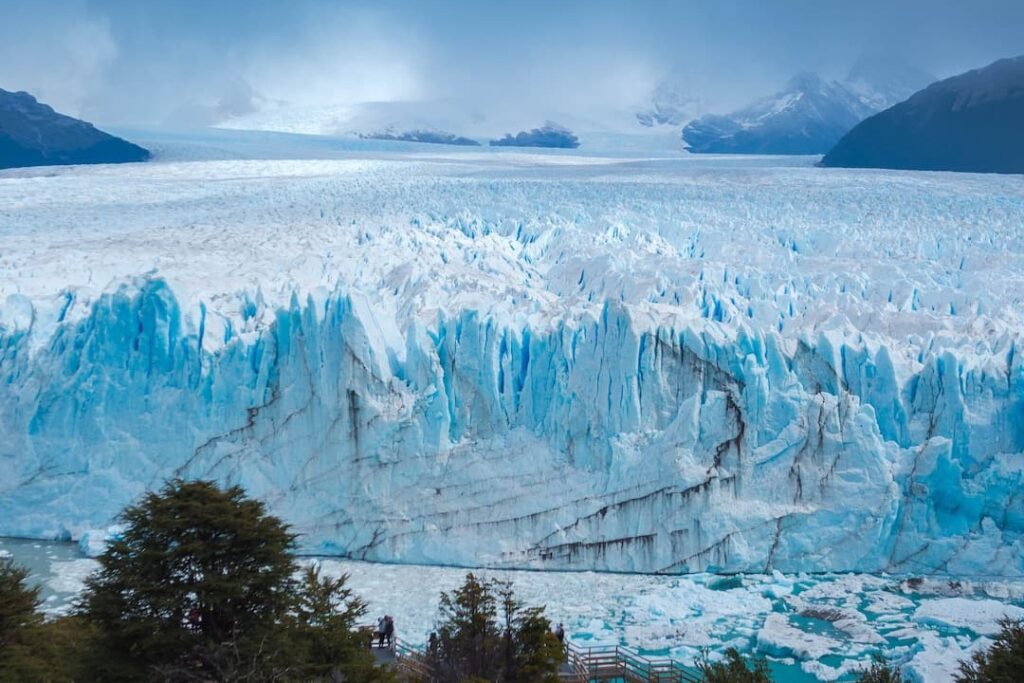
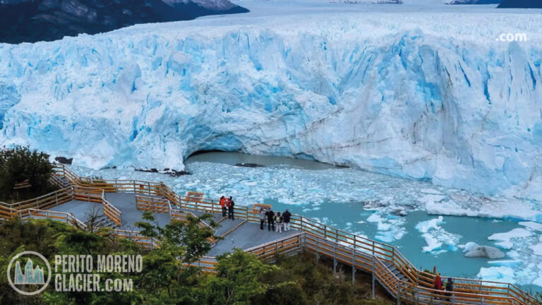
Perito Moreno is famous not because it is the largest glacier in the system, but because its terminus can be observed safely and clearly from an extensive network of walkways. The viewpoints reveal the glacier as a moving body: fractured towers, compression zones, blue crevasses and occasional calving can be seen and heard across the Canal de los Témpanos.
Travelers may combine the walkways with a boat trip or, subject to operating conditions and eligibility requirements, a guided ice trek. These experiences explore one outlet of the ice field rather than the high central plateau.
For activity details, link to: What to Do at the Perito Moreno Glacier.
Upsala Glacier: Scale, Icebergs and a Changing Landscape
Upsala flows into the northern arms of Lago Argentino. It is best appreciated through full-day navigation routes or from elevated viewpoints reached through the Estancia Cristina area. Large icebergs may restrict how closely boats can approach, but this is not a lesser experience. The iceberg field, broad valley and distant front communicate the glacier’s scale and rapid evolution.
The viewpoint experience is particularly useful for understanding the difference between a glacier, its proglacial lake and the much larger ice field feeding it from beyond the visible mountains.
For a land-and-water perspective, link to: Four Tours to Enjoy Estancia Cristina from El Calafate.
4×4 Adventure in Patagonia: Cerro Frías Exploration
Experience a thrilling 4x4 journey through Patagonia, featuring breathtaking views and unique landscapes.
Spegazzini Glacier: A Dramatic Lake-Level View
Spegazzini descends toward the Spegazzini Arm of Lago Argentino and is renowned for its exceptionally high terminal face. It is normally visited on longer glacier cruises departing from the Puerto Bandera area. The approach through narrow channels and mountain scenery creates a strong sense of entering the outer margins of the ice field.
Viedma Glacier: The Northern Argentine Outlet
Viedma Glacier drains toward Lago Viedma near El Chaltén. The broader area combines glacial landscapes with views of the Fitz Roy and Torre massifs. Conditions, access routes and commercial activities around the glacier have changed over time, so travelers should verify which navigations or guided options are operating for their dates rather than relying on older itineraries.
Grey Glacier: The Torres del Paine Connection
On the Chilean side, Grey Glacier descends into Lago Grey within Torres del Paine National Park. It can be viewed from trails, by navigation and through authorized guided activities. Grey is a useful addition for travelers combining El Calafate with Puerto Natales or Torres del Paine because it demonstrates how the same ice field appears in a wetter, more mountainous setting.
Remote Western Glaciers
Pío XI, O’Higgins and other western outlets lie in a far less road-accessible landscape. Reaching them generally involves multi-day cruises, long navigations or specialist expeditions. These are not casual extensions from El Calafate, and itineraries should include substantial time buffers for weather.
How Can an Ordinary Traveler See the Ice Field?
The phrase “visit the Southern Patagonia Ice Field” can describe very different experiences. Choosing correctly depends on what the traveler actually wants to see and how much physical effort is appropriate.
1. Panoramic Observation
This is the most accessible option. Walkways, lake-level viewpoints and elevated overlooks allow visitors to observe outlet glaciers without stepping onto ice. Perito Moreno is the clearest example, while viewpoints near Estancia Cristina provide a broader landscape perspective over the Upsala basin.
Best for first-time visitors, photographers, families, seniors and travelers who want major scenery without expedition-level demands.
2. Glacier Navigation
Boat tours reveal the relationship between ice, mountains and lakes. Short cruises focus on a single face; longer routes explore several arms of Lago Argentino and may include Upsala, Spegazzini and other glacier-fed landscapes.
Navigation schedules and routes depend on wind, visibility, ice conditions and safety decisions. A distant view caused by floating ice should be understood as part of a dynamic environment, not as a failed visit.
For planning, link to: Is It Worth Doing the Glacier Boat Tour?.
El Calafate, Perito Moreno & Estancia Nibepo Aike – 4 Nights
A wonderful 4-night program to visit Perito Moreno, navigate the Lake Argentino and staying in a typical Patagonian Ranch!
3. Guided Glacier Trekking
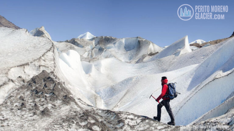
An authorized ice trek introduces the surface world of a glacier: crevasses, meltwater channels, moulins and changing textures. The operator supplies technical equipment such as crampons and sets age, fitness and medical restrictions.
This is not equivalent to crossing the Southern Patagonia Ice Field. It is a controlled guided activity on an accessible portion of an outlet glacier.
4. Mountain Viewpoints and Multi-Day Treks
Experienced hikers can see portions of the ice field from routes around El Chaltén and Torres del Paine. Some advanced circuits approach passes or high viewpoints overlooking the frozen plateau. Weather, river levels, snow, route finding and strong wind can transform the difficulty quickly.
Independent day hikes on marked trails are fundamentally different from technical journeys onto glaciers or into remote border areas.
5. A Full Ice-Field Expedition
Crossings and traverses of the ice field are serious mountaineering undertakings. They may involve crevasse rescue systems, rope travel, whiteout navigation, sleds, snow camping and complex evacuation planning. Only appropriately experienced travelers should consider them, and then only with specialist guides, permits and a flexible schedule.
For most visitors, the more rewarding decision is to combine two or three complementary perspectives—walkways, navigation and an elevated viewpoint—rather than trying to reach the central ice plateau.
Choosing a Base: El Calafate, El Chaltén or Puerto Natales
El Calafate
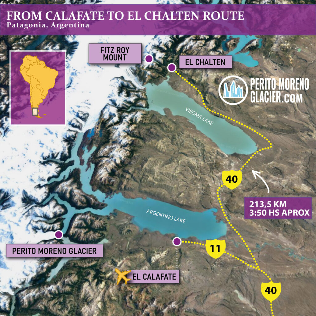
El Calafate is the principal base for Perito Moreno Glacier, Lago Argentino cruises, Puerto Bandera and Estancia Cristina. It has an airport, a broad accommodation range and the most developed excursion network on the Argentine side.
Choose El Calafate if glaciers are the main focus and you want accessible options with organized transport.
El Chaltén
El Chaltén is the trekking base for the northern sector of Los Glaciares National Park. Its experience is dominated by trails, granite peaks, changing weather and views across glacier-shaped valleys. It complements El Calafate rather than replacing it.
Choose El Chaltén if hiking and mountain landscapes are priorities.
Puerto Natales and Torres del Paine
Puerto Natales is the logistical gateway to Torres del Paine and Grey Glacier. Combining it with El Calafate adds a border crossing and substantial road travel but reveals the environmental contrast between both sides of the Andes.
Choose this combination if you have at least several extra days and want a broader Patagonian journey rather than a single glacier visit.
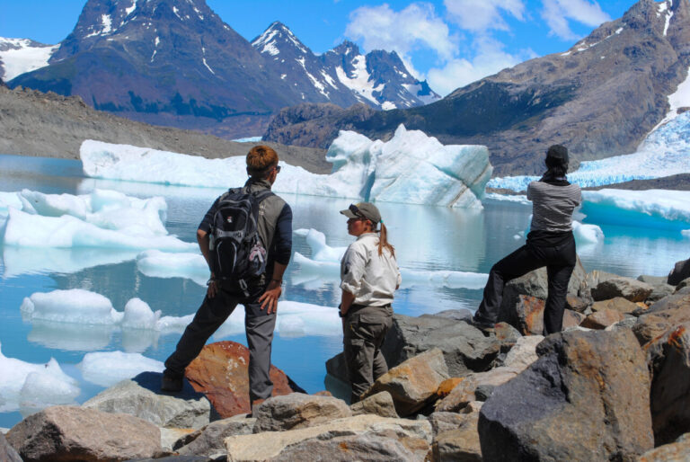
Glaciar Sur Aventura Full Day Trekking Experience
Explore remote landscapes with a full day of sailing and trekking among hidden glaciers.
How Many Days Do You Need?
A useful minimum is three nights in El Calafate, allowing one full day at Perito Moreno and another full day for a Lago Argentino navigation or Estancia Cristina experience. Four nights provide a weather buffer or space for another activity.
Add two or preferably three nights in El Chaltén for trekking. Add three or more nights for Puerto Natales and Torres del Paine, depending on the route and activities.
Trying to compress El Calafate, El Chaltén and Torres del Paine into a few days often produces more time in vehicles than in the landscape.
For a fuller itinerary discussion, link to: How Many Days to Spend in El Calafate.
Best Time to Visit the Southern Patagonia Ice Field
For mainstream sightseeing, the most practical season is generally October through April. Days are longer, more excursions operate and hiking access is usually broader. December to February brings the longest daylight and highest visitor numbers; October–November and March–April can offer a good balance of services, lower demand and seasonal color.
There is no guaranteed calm or clear month. Strong wind, cold rain, snow and rapid visibility changes are possible even in summer. Conversely, a cloudy day can enhance the blue color and texture of the ice by reducing harsh glare.
Winter travel can be beautiful but requires a different plan. Daylight is shorter, some routes and services close, roads may be affected by snow or ice, and mountain access becomes more technical.
For monthly conditions, link to: Weather in El Calafate and the Perito Moreno Glacier Area.
El Calafate Special Adventure Program: Big Ice and Horseback Riding or Trekking in Estancia Cristina
Enjoy visiting Perito Moreno Glacier, walking over the ice of the glacier and a wonderful trekking or horseback riding in a remote estancia in the national park

Understanding Patagonia’s Rapid Weather Changes
The central ice field creates its own severe local conditions, while the Andes amplify wind and precipitation. A forecast for El Calafate does not necessarily describe conditions at Perito Moreno, Lago Argentino’s western arms or a high trail near El Chaltén.
Plan with layers rather than one heavy garment. Carry a waterproof and windproof outer shell, protect hands and head, and keep insulation dry. On boats, moving air makes the exposed decks feel significantly colder than the town. On sunny days, snow and ice reflect ultraviolet radiation, so sunglasses and sunscreen remain important even when temperatures are low.
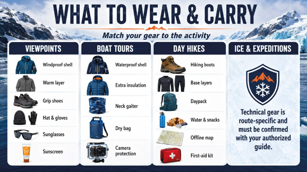
What to Pack for Different Levels of Activity
For Walkways and Boat Tours
- Waterproof, windproof jacket
- Warm mid-layer
- Comfortable trousers
- Closed walking shoes with good grip
- Warm hat and light gloves
- Sunglasses with reliable UV protection
- Sunscreen and lip balm
- Small water bottle
- Compact daypack and waterproof protection for electronics
For Day Hikes
Add proper hiking footwear, moisture-wicking base layers, extra food and water, a basic first-aid kit, offline navigation, a charged phone and an additional insulating layer. Trekking poles may help on uneven or windy terrain.
For Guided Ice Activities
Follow the authorized operator’s list exactly. Technical items such as crampons, helmets or harnesses are normally supplied for commercial glacier activities. Do not bring or improvise equipment as a substitute for an authorized guide.
For Remote Expeditions
Equipment is expedition-specific and may include glacier boots, rope and rescue systems, snow anchors, sleds, tents suitable for extreme wind, satellite communication, navigation redundancy and emergency shelter. Packing decisions must be made with the guiding team, not from a generic online checklist.
Safety: The Ice Is Always Moving
Glaciers can look motionless, but they deform, fracture and flow continuously. Calving can generate waves; crevasses can be hidden by snow; meltwater changes the surface; and unstable ice or rock may collapse without warning.
Travelers should remain within designated areas, obey park staff and guides, and never walk onto glacier ice without an authorized activity. Do not climb barriers for a better photograph, approach floating ice along an unsafe shore or fly drones where prohibited.
For commercial activities, review age limits, physical requirements and medical exclusions before booking. These rules can change and are part of the safety system, not mere formalities.
The Science Travelers Can See
Blue Ice
Dense glacier ice absorbs more red wavelengths of visible light and allows more blue light to return to the observer. The effect becomes stronger in thick, compact and freshly fractured ice. Surface snow may look white because air bubbles scatter a broader range of light.
Crevasses and Seracs
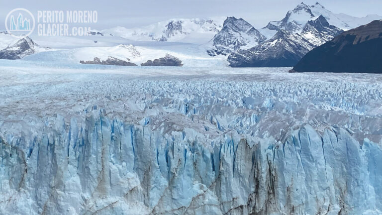
When ice moves across irregular terrain or around obstacles, stress opens fractures known as crevasses. Intersecting fractures can create unstable towers called seracs. Their patterns help reveal how the glacier is accelerating, bending or compressing.
Glacial Flour and Milky Water
Moving ice grinds bedrock into extremely fine sediment. Suspended in meltwater, this “glacial flour” gives lakes and rivers grey, turquoise or milky tones depending on particle concentration and light conditions.
Moraines
Dark bands and ridges of rock debris record the transport and former positions of ice. Lateral moraines form along glacier margins; medial moraines may appear where glacier branches join; terminal moraines can mark a former maximum advance.
Calving
Where a glacier ends in water, blocks detach from the front and form icebergs. The visible splash is only the final stage of a process controlled by ice flow, buoyancy, fractures, water depth and temperature. Calving cannot be scheduled or safely predicted for tourists.
Both Sides of Southern Patagonia: El Calafate & Puerto Natales
Wonderful 6-night program to combine El Calafate and Perito Moreno Glacier with Puerto Natales and Torres del Paine National Park
Climate Change and a Landscape in Transition
The Patagonian ice fields are losing mass overall, and many outlet glaciers have retreated substantially. The rate and pattern are not identical everywhere: snowfall, elevation, bedrock topography, lake depth, water temperature and glacier geometry can make neighboring glaciers behave differently.
That is why one glacier should never be used as a simple stand-in for the entire ice field. A glacier may pause, advance temporarily or retreat rapidly while the regional system continues to lose ice. Even Perito Moreno—long presented as unusually stable—must be understood through current scientific monitoring rather than a permanent label.
For travelers, responsible interpretation means avoiding two extremes: treating every calving event as direct proof of climate change, or assuming that a spectacular glacier front indicates a healthy, unchanged ice field. Long-term measurements, satellite observations and field research provide the meaningful evidence.
Responsible Travel in the Ice-Field Region
- Use established trails, walkways and authorized operators.
- Keep a safe distance from wildlife and never feed animals.
- Carry waste out of remote areas and reduce disposable packaging.
- Do not remove rocks, plants, fossils or pieces of ice.
- Follow fire restrictions and campsite rules.
- Avoid contaminating lakes and streams with soap or food waste.
- Respect guide decisions when wind, ice or visibility changes the route.
- Spend locally where possible and allow enough time to experience each base rather than racing between sites.
The goal is not merely to leave no litter. It is to reduce disturbance in an environment where vegetation grows slowly, rescue resources are limited and weather can turn a minor error into a serious incident.
El Calafate Tour Package: 1–3 Nights
Enjoy visiting Perito Moreno Glacier and other amazing attractions in the area. Choose between our 1-2-3 night packages and discover Patagonia
A Practical First-Time Itinerary
Day 1: Arrival in El Calafate
Use the arrival day to settle in, review the forecast and confirm excursion pickup times. Visit the lakeshore or a local interpretation center if the schedule allows.
Day 2: Perito Moreno Glacier
Combine the walkways with a navigation or an authorized ice activity appropriate to your fitness. Focus on the glacier’s movement, fractured surface and relationship with the surrounding forest and lake.
Day 3: Lago Argentino’s Northern Arms
Choose a full-day navigation, Estancia Cristina or another itinerary giving access to the Upsala and Spegazzini sectors. This day reveals the scale of the glacier system beyond Perito Moreno.
Day 4: Geological and Cultural Context
Keep a flexible day for weather, steppe landscapes, local history or a second glacier experience. This buffer is especially useful when a boat route or activity is weather-dependent.
Optional Extension: El Chaltén
Travel north for two or three nights of hiking. The granite massifs, hanging glaciers, moraines and river valleys show how ice has built the broader landscape, even when the main plateau remains out of sight.
2-day expedition to Cagliero Glacier from El Chalten
Enjoy a wonderful trekking in two amazing days in the area of the Fitz Roy Mount
Common Questions About the Southern Patagonia Ice Field
Can You Drive to the Southern Patagonia Ice Field?
You can drive to visitor areas associated with its outlet glaciers, including the Perito Moreno sector. You cannot drive onto or across the central ice field. Many other sectors require boats, hikes or expedition logistics.
Can You See It from El Calafate?
Not as one continuous white plateau from the town center. El Calafate is the base from which travelers reach several outlet glaciers and viewpoints connected to the ice field.
Is Perito Moreno the Southern Patagonia Ice Field?
No. Perito Moreno is one outlet glacier fed by the much larger Southern Patagonia Ice Field.
Is It the Third-Largest Ice Field in the World?
Rankings depend on whether sources compare ice fields, ice sheets, contiguous systems or only extrapolar regions. The most accurate travel wording is that it is one of the world’s largest contiguous ice masses outside the polar ice sheets and the largest temperate ice mass in the Southern Hemisphere.
Do You Need a Guide?
Not for standard public walkways or many marked day hikes. A guide is mandatory or strongly necessary for glacier trekking, technical routes, remote terrain and ice-field expeditions.
Can Children and Seniors Visit?
Many viewpoints, walkways and cruises are suitable for a wide range of ages, subject to mobility and current operating conditions. Ice treks and demanding hikes have stricter limits. Select the experience first, then check its exact requirements.
Are Tours Guaranteed to Reach Every Glacier?
No. Wind, visibility, floating ice, lake conditions and operational decisions can change routes. Flexibility is part of traveling in an active glacial landscape.
4×4 Adventure in Patagonia: Cerro Frías Exploration
Experience a thrilling 4x4 journey through Patagonia, featuring breathtaking views and unique landscapes.
Final Perspective: Visit the System, Not Just One Viewpoint
The Southern Patagonia Ice Field is most rewarding when understood as a connected system. The ice begins as snowfall high in the Andes, becomes part of a slowly moving plateau, descends through separate glaciers, releases sediment and freshwater, calves into lakes and fjords, and continues shaping the land long after the ice front has moved.
A first-time traveler does not need expedition skills to appreciate that story. From El Calafate, a carefully planned combination of Perito Moreno, a full-day Lago Argentino experience and—if time permits—El Chaltén offers three distinct perspectives without repeating the same activity. Add Grey Glacier and Torres del Paine for the contrasting Chilean side.
The essential planning principle is simple: choose complementary viewpoints, allow for Patagonia’s weather, and treat every glacier as one moving part of a much larger frozen landscape.
Editorial Fact-Checking Note
Ice-field area, glacier dimensions, access rules, activity limits and operating routes change over time and may differ among scientific datasets. Before publication, retain approximate wording for measurements and verify bookable activities against current operator and national-park information.